File:LazarHoMap (1280x914).jpg
Jump to navigation
Jump to search

Size of this preview: 800 × 571 pixels. Other resolutions: 320 × 229 pixels | 1,280 × 914 pixels.
Original file (1,280 × 914 pixels, file size: 1.2 MB, MIME type: image/jpeg)
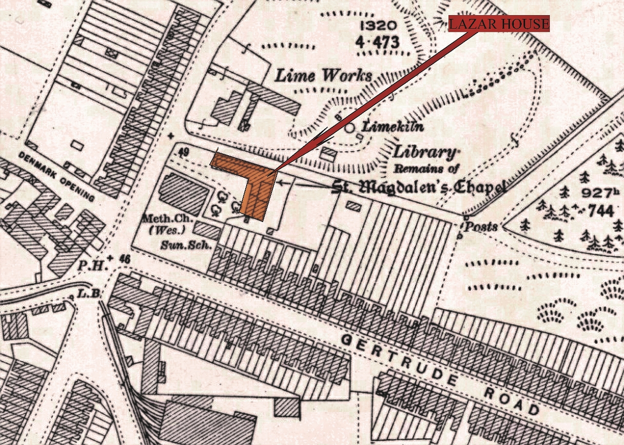
Location Map of Lazar House from 1912 map TBuilding TMap Date 1910s
File history
Click on a date/time to view the file as it appeared at that time.
| Date/Time | Thumbnail | Dimensions | User | Comment | |
|---|---|---|---|---|---|
| current | 23:13, 2 August 2017 | | 1,280 × 914 (1.2 MB) | Bev (talk | contribs) | Location Map of Lazar House from 1912 map |
- You cannot overwrite this file.
File usage
The following page uses this file:
.jpg&oldid=4330)
.jpg)
.jpg&action=edit&redlink=1)
.jpg&action=edit)
.jpg&action=history)
.jpg)
.jpg)
.jpg&printable=yes)
.jpg&oldid=4330)
.jpg&action=info)